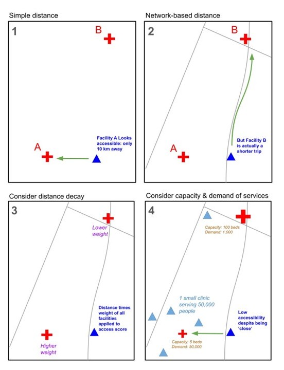
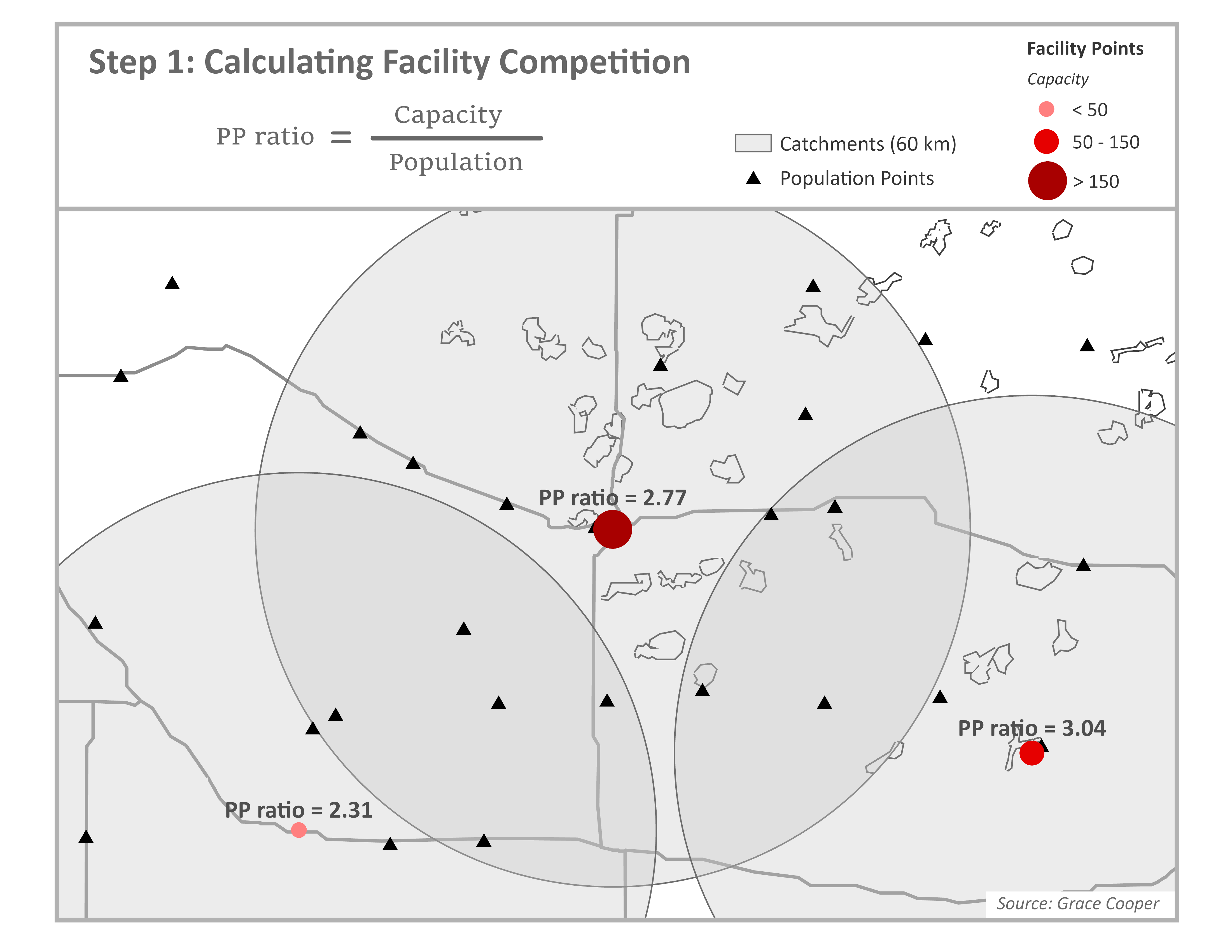
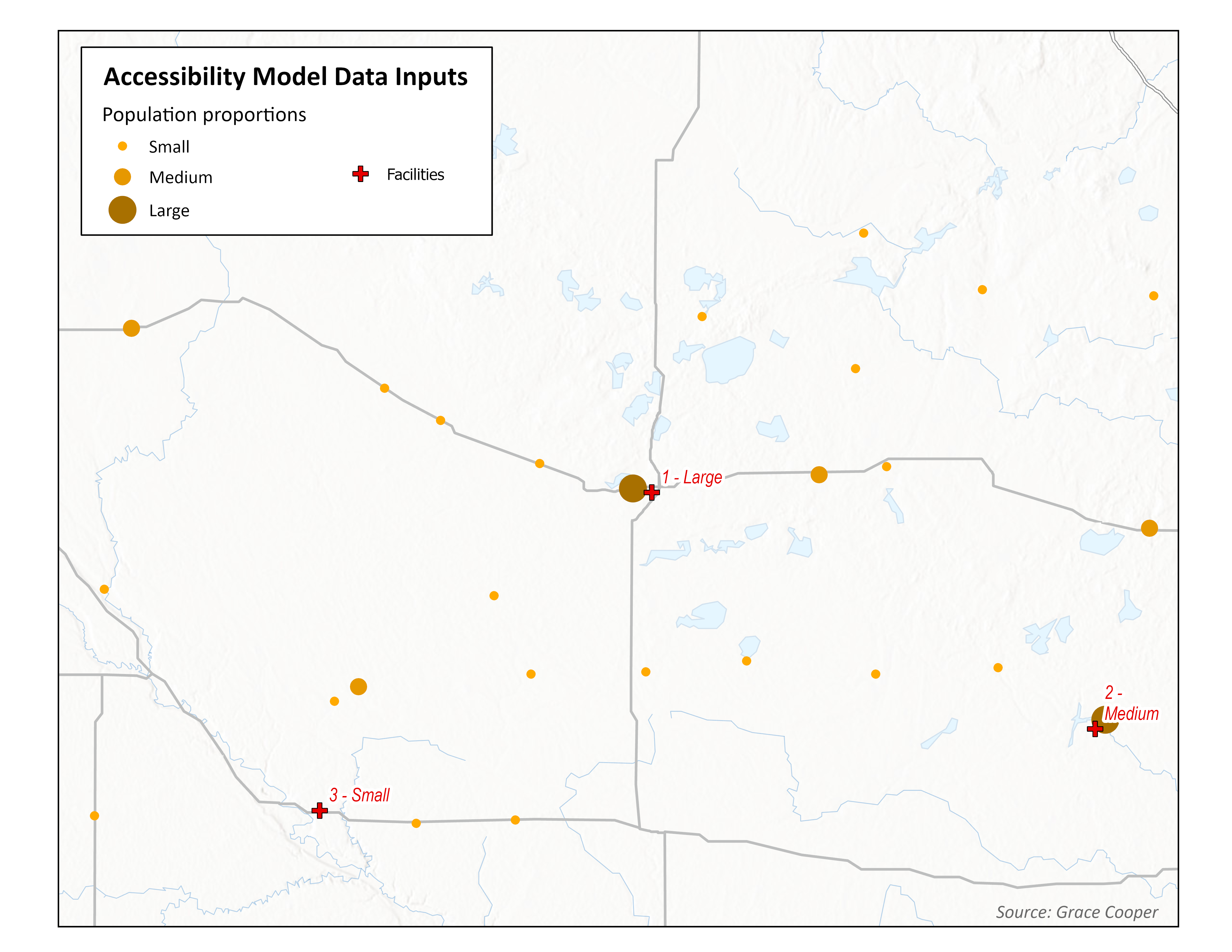
Many people in developing countries experience poor health as a result of poor spatial access to clinics and hospitals. Our understanding of how to improve global health is limited by our ability to measure healthcare accessibility.
An almost overwhelming number of vegetative and land cover data types exist. This post describes and compares sources of land cover data, as the final installment of a series of three.
An almost overwhelming number of vegetative and land cover data types exist. This second post of three describes a few common indices representing vegetative or soil moisture, with an emphasis on agricultural productivity.
An almost overwhelming number of vegetative and land cover data types exist. As the first post in a series of three, this blog gives a brief primer into vegetative indices and which ones might be most appropriate for different research goals.
A follow-up post on using a comparable measure of dietary diversity in a multilevel model including NDVI contextual information in the model.
In the final post in our series on future estimation we create a model to predict child malnutrition and plug in projected climate scenario data to predict a future level of child malnutrition.
Returning to our series on future estimation, we provide an overview of a data source for future climate scenarios.
An introduction to constructing comparable dietary diversity indicators. This post breaks away from the series on future conditions, with the first post of two on dietary diversity.
Use the DHS to estimate fertility levels and project future population levels
Part 1 in our series exploring climate and population projections in health research
Update your NDVI workflows with NASA’s newest instruments
Spatiotemporal research is enhanced when guided by local knowledge, perspective, and expertise.
Standalone GIS software can provide an interactive alternative to code-based analysis workflows
Exploring customization options for leaflet maps
An introduction to interactive mapping using the leaflet package
An introduction to gridded data sources used to measure human presence across the globe
We use data from two regions to illustrate approaches to processing NDVI data
Use purrr and terra to efficiently integrate NDVI data across multiple spatial extents
Satellite imagery can be used in conjunction with place-specific research methods to assess food production and its impacts
Understanding the challenges when using longitudinal data with DHS surveys
Fine-tune an analysis by incorporating temporal information from a DHS survey with longitudinal environmental data
Generalize your code to more easily aggregate time-varying environmental data
A demonstration of data and techniques to handle shifting geographic boundaries in longitudinal research
Some factors to consider when obtaining and preparing precipitation data for use with DHS surveys
Remotely sensed precipitation data can provide important context for understanding the health outcomes reported in the DHS
Introducing the theoretical foundations for effective research on weather extremes and health
Identify and download data from the IPUMS DHS website and load it into R
Getting started with R and RStudio